
The map catalogue of Beekman
The collection of a pioneering historian
The historical geographer Anton Albert Beekman (1854-1947) is known as one of the Dutch pioneers in the field of the history of cartography. In the multi-volume Geschiedkundige atlas van Nederland (1913-1938) (‘Historical atlas of the Netherlands’) for which Beekman himself drew maps and wrote several texts, he combined his enthusiasm for history, geography and cartography. The sources for this lifework and for many other publications were to be found in his expansive private library. In addition to books also maps were part of the collection. Utrecht University Library houses the map catalogue handwritten by Beekman. This catalogue offers a splendid insight into the composition of an early 20th-century private collection? And what was its significance from a historical-cartographic viewpoint?
Leading role

At the end of the 19th century and in the first half of the 20th century Beekman played a leading role in the practice of geography. He stood at the cradle of modern geography in the Netherlands and in particular the hydraulic situation in the lower parts of the Netherlands was one of his specialties. This revealed itself in the publication Nederland als polderland (‘Netherlands as polder country’) from 1884, followed by several revised editions up to 1932. The book was a breakthrough for Beekman who showed a strong interest in this and also later publications for the historical dimensions of geographical phenomena. And that is why maps, in which these kinds of phenomena were visualized, were his favourites. And even to such an extent that he took up the drawing pen and produced all kinds of clarifying maps.

Atlases and maps
Besides the Geschiedkundige atlas van Nederland mentioned earlier, Beekman’s cartographic skills resulted in, whether or not with the cooperation of Roelof Schuiling, the following atlases:
- Schoolatlas van Nederland (1889-1929); (‘School atlas of the Netherlands’)
- Schoolatlas van de geheele aarde (1893-1927); (‘School atlas of the entire earth’)
- Atlas van Nederland (ca. 1890-1892); (‘Atlas of the Netherlands’)
- Kleine schoolatlas van Nederland (ca. 1890-ca. 1913); (‘Small school atlas of the Netherlands’)
- Kleinste atlas van Nederland (1892-1897). (‘Smallest atlas of the Netherlands’)
In many of his other books and articles he included his self-drawn maps. As a supporter of the damming and partial reclamation of the Zuiderzee we should not be surprised that he published many planning maps on this subject.
Beekman: self-taught man in the field of geography
At first a career in the military seemed to be his destination. After all, his father belonged to the rank of officers, as did many of his relatives on both paternal and maternal side. That is why Beekman was a student at the Koninklijke Militaire Academie (‘Royal Military Academy’) from 1870 to 1873 and was next stationed in Delft and later on in Utrecht. In the latter city he dedicated himself to the further completion of the Nieuwe Hollandse Waterlinie, gaining a lot of experience in water management. Soon, in 1879, he took honourable discharge and went to work as a mathematics teacher in Zutphen. In his spare time he studied, published and gave especially (historical-)geographic lectures.
Period in The Hague

In 1891 he accepted the job of director of the HBS (former Dutch High School for the 12-18 year age group) in Schiedam, which did not leave him much time for studying and publishing. That is why he went back to teaching at the second HBS in The Hague, till he retired early in 1916 due to hearing problems. In this city Beekman had access to all kinds of large libraries and archives, which provided him with the necessary material for hundreds of publications. He also got in contact with the most prominent scholars and dignitaries. His period in The Hague – Beekman lived there till his death – became his most productive one from a scholarly point of view. The bulky Geschiedkundige atlas van Nederland bears witness to this fact.
Expansive private library
For his publications Beekman not only made use of what his own observations, personal contacts and large libraries and archives had to offer, but also of his own expansive private library. Probably Beekman only started to actively set up his private collection after the move to The Hague. There is a typed catalogue of the books and manuscripts in this library, with handwritten supplements by Beekman himself. A carbon copy is housed in Utrecht University Library (Kaart: *VI*.C.165b).
Cumulative catalogue of books and manuscripts
The catalogue of books and manuscripts mentioned above mainly contains works related to the Netherlands: after all, that was the area Beekman was interested in. A total of almost 1,900 titles is mentioned, listed thematically and regionally. After a few general thematic sections for the Netherlands as a whole the regional classification follows, in which the provinces of the lower parts of the Netherlands are mentioned first. Not surprising, because these economic nuclear areas drew his special historical-geographic attention. Up to 1930 the ‘cumulative’ catalogue was kept up to date in typed format; after that Beekman wrote down the supplementing titles by hand. The most recent work dates back to 1944.
Beekman’s map catalogue
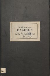
Moreover, Beekman made a separate map catalogue which beautifully illustrates the size and content of his private cartographic collection. What does the map catalogue look like in terms of setup and content? There is a clear similarity with the catalogue of books and manuscripts. For instance, the map catalogue has a comparable setup, starting with general references to cartographic and geodetic reference works and to some map bibliographies. Next follows a list of general maps and atlases for the whole of the Netherlands or large parts of the country. Within this section we also find the thematic river maps and hydrographical maps exceeding the province borders. Just as in the catalogue of books and manuscripts the regional division in ‘counties’ is next, and also now the provinces of the lower parts of the Netherlands come first. The same goes for the town plans which form a separate category at the end of the catalogue.

Fully handwritten
In some aspects the map catalogue is different from the catalogue of books and manuscripts: the larger part of the descriptions in the latter catalogue have been made on the typewriter, only 170 of the almost 1,900 entries have been written by hand by Beekman. On the other hand, the map catalogue is almost completely written by hand. Probably Beekman started on his map catalogue in 1915 and must have continued including descriptions till at least 1934. It may well be possible that he added new titles until his death in 1947, but this time of documents which had appeared, sometimes years even, before 1934.

The map collection in figures
From a quantitative point of view Beekman’s map collection did not come near his collection of books and manuscripts, but was all the same quite impressive for a private collection. Compared to the almost 1,900 titles of books and manuscripts the over 300 cartographic documents form a rather sharp contrast at first sight. However, if we count the number of map leaves, many of Beekman’s maps contain multi-leaf wall maps, we come to the respectable number of over 1,500 items. Approximately half of the collection dates from the period 1651-1800 and a quarter from the second half of the 19th century.
Focus on the west of the Netherlands
From a regional viewpoint there was a strong focus in Beekman’s map collection on the lower parts of the Netherlands; more than a third of the collection contained maps of the provinces Zuid-Holland, Noord-Holland and – to a lesser degree – Friesland and Zeeland. The focus was on water management maps and more specifically on large quantities of large-scale material which was made by or commissioned by the district water control boards. For instance copies of the famous wall maps of Rijnland by Jan Jansz. Dou and Steven Pietersz. Van Broeckhuijsen from 1647 (editions 1687 and 1746), of Delfland by the Cruquius brothers from 1712 and of the Uitwaterende Sluizen in Kennemerland and West-Friesland by Dou from 1680.

Cartographic gems
Besides Beekman had the disposal of a relatively large number of river maps and hydrographical maps that went beyond regional borders. This material made up for approximately a sixth part of his collection. In the case of the river maps it mainly concerned 18th century cartographic documents describing river-related situations and improvements. The hydrographical part mainly covered map leaves from the 19th and early 20th century, published by the Ministery of Marines. Finally over sixty town plans of mainly western Dutch cities are included in Beekman’s catalogue, including cartographic gems such as Munro’s four-sheet map of Rotterdam from 1800 and several illustrations of places from Joan Blaeu’s town book. Two town plans of Antwerp and one of Ghent are among the few representations of foreign cities.
Use and significance of the map collection
Numbers mentioned above and specific examples of maps show that Beekman came into the possession of a considerable map collection in the course of the 20th century. In view of the quite large number of cartographic gems Beekman must have been a rich man, although at that time old maps were not sold for astronomic amounts yet. We may safely assume that he bought the cartographic jewels mainly at auctions and in antiquarian bookshops. In addition, Beekman had material at home from the Koninklijk Nederlands Aardrijkskundig Genootschap (KNAG) (‘Royal Dutch Geographical Society’) of which he was a very active member around 1930.
Great passion
Without a doubt Beekman used his own old maps as important sources for his historical-geographic publications. In addition, it cannot be denied that he cherished a great passion for historical cartography. This mainly appears from the two big map exhibitions which were held in 1917 and in 1921 in the Amsterdam Stedelijk Museum. As an expert, Beekman was involved in organizing the exhibition, and he wrote the extensive exhibition catalogues (Beekman, 1917 and 1921). Both exhibitions, the first on the historical geography of Holland north of the IJ and the second on the area between the Maas and the IJ, were a huge success and attracted crowds of visitors.
Not wanting to share his maps?
Unlike we are used to today is the large number of items on show. The 1917 catalogue counts almost 630 numbers, whereas the one from 1921 mentions at least around 1,000 cartographical and topographical documents! Also the people and institutions that gave the items on loan are listed in the catalogues and one would expect Beekman to be one of them. But such is not the case; for the 1917 exhibition Beekman only gave six maps on loan and in 1921 no more than nine. The larger part of the pieces came from national institutions and libraries. It could be that Beekman’s collection was not that extensive at the time or that he did not like to share his own maps. Either way, at the end of his life Beekman could take pride in a very attractive map collection. A collection that, especially for the western and the lower parts of the Netherlands, offered a well-balanced sample of what was available in the field of 17th-19th century cartography, in particular large-scale, official map material.
Auction of Beekman’s library
What was the end of Beekman’s collection of books and maps? We know that a representative of bookstore and publisher Nijhoff – Wouter Nijhoff was a close friend of Beekman’s – had a look at the entire library and made a taxation as soon as 1922. Only in 1943 the library was sold for real to Nijhoff, providing that Beekman could keep the library as long as he thought necessary. In the end Nijhoff put the library up for auction after Beekman’s death in 1947.
These atlases are monuments of cartography
‘Splendid collection’
In the auction catalogue Waterways, Dikes, Polders […] of 1949, counting 620 lots, the following is said of Beekman’s collection: ‘This collection is brought together about 70 years by Dr. A.A. Beekman […]. I beg to draw your special attention to the splendid collection of maps and the famous atlases of the so-called “Hoogheemraadschappen” (high offices of the dike-reeves), which were published in the 17th and 18th centuries. These atlases are monuments of cartography […]. As it would be impossible to again bring a similar collection together, which contains ab. 1325 books, atlases and tracts, 225 single maps and moreover the Zuiderzee collection, it will be sold en bloc. The price of the collection is Gld. 15.000.–.’
Entire collection put up for auction?
So especially the cartographical component of Beekman’s collection is spoken highly of. However, it does not look like the whole collection came under the hammer during that auction. The numbers of 1,325 books and 225 maps do not add up to the lists in the catalogue of books and manuscripts (almost 1,900 items) and the map catalogue (over 300 items). For instance many town plans were not put up for auction. At any rate, they do not appear in the auction catalogue which had a mainly hydraulic focus after all.
Child’s play
Whether the collection of publications on water management were really sold ‘en bloc’ is not clear. It is certain that an important part, including many maps, were bought by the then Technische Hogeschool in Delft, now Delft University of Technology and probably also by the Landbouwhogeschool in Wageningen. Because Beekman’s name unfortunately does not occur in the provenance date of the libraries, further investigation is needed to establish this. In what way the map catalogue ended up in the Utrecht University Library remains a mystery for the time being.** However, with the help of this recovered catalogue the reconstruction of Beekman’s cartographic collection is mere child’s play!
Notes
* A more extensive article about the map catalogue by Beekman is published in the journal Caert-Thresoor 35.1 (2016), 'De kaartenverzameling van Anton Albert Beekman' / Marco van Egmond, p. 3-10.
** After publication of the above mentioned article dr. Frans Scholten expressed the suspicion that the maps, not auctioned in 1949, were finally donated to the Utrecht Geographical Institute by the widow of Beekman. A lot with topographical maps - some of them bearing the signature of Beekman - was for example in use by a teacher in historical geography who escorted Scholten's master thesis. About 2000 these maps were auctioned at Beijers in Utrecht. The map catalogue was at that time probably part of the gift by the widow of Beekman, but fortunately not auctioned later.
Mr. V. Zeijlemaker, great-grandchild of Beekman, then pointed out that the 'widow' Beekman - Wilhelmina van Deventer - died already on June 22, 1916 at the age of 61. So earlier than her husband. So it is likely that Nijhoff kept the catalog to the last and presumably intended it to be used as desired.