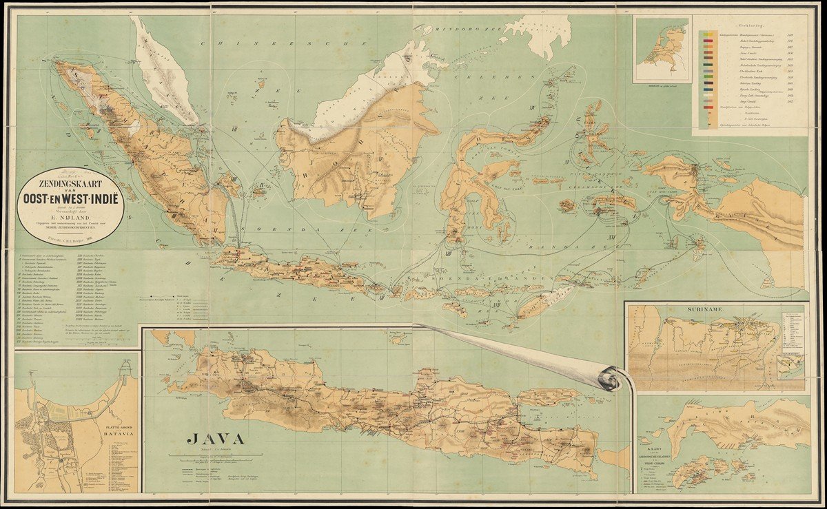
'Zendingskaart van Oost- en West-Indië', 1891
One of the most beautiful Dutch mission maps was made by Evert Nijland in 1891. This map shows the archipelago of the Dutch East Indies, with smaller inserts of Ambon, Java and Batavia. An inset map also shows Suriname. It is a very detailed map showing posts from all Dutch mission organizations, including Catholic ones. Names of places are underlined if European or ‘Native’ missionaries are active in those cities. Colonial administrative units (residences) are also clearly marked. Also remarkable are the routes of the Dutch Packet Boat Service, which operated with steamers in the archipelago.
Nijland was director of a Utrecht Reformed school and board member of the Utrecht Missionary Society (UZV), and was very interested in geography and ethnology. The map shows very clearly the intertwining of missionary and colonial interests: in fact, this map is both a missionary and colonial map. That is how it was intended: Nijland tried, without success, to get the support of the Dutch government to make this map the standard for Dutch schools. In a survey of schools in 1938, which also examined the distribution of the Nijland map, the committee stated:
‘Our colonies are brought more to the knowledge of our students through missionary education, which aims to arouse interest. The great masses have no tangible immediate interest in our overseas property, and feel no closer to our possessions in the East and West than to Japan and Canada. Yet once missionary education has focused attention on our colonies, there is a chance that it will be permanent, especially if one is careful not to maintain them beyond the school years'.
The Nijland map was popular but also quite expensive. The large version, a wall map, was used in schools and cost about 13.50 guilders around 1900, the small version for the study cost 2.50 guilders. Teachers often found the very detailed map too complicated for educational purposes.


