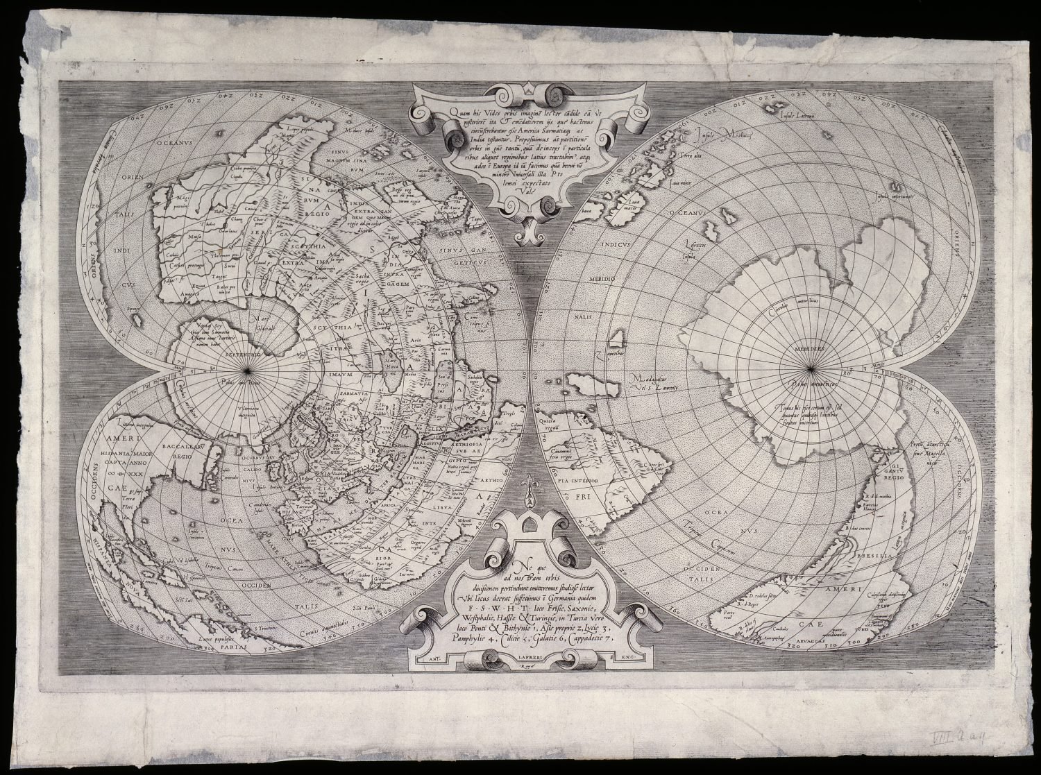
World map Mercator by Lafreri
An unusual view of a fairly unknown world
Published in 1538, the Orbis Imago, is the first map of the world drawn up by Gerard Mercator. It is his second published map. It is not completely original: Mercator copied the Nova et Integra Universi Orbis Descriptio by Orontius Finaeus from 1531, but made a few significant changes. For example, ‘America’ was used to refer to both North and South America for the first time, with both parts of the New World joined together as one continent. Mercator also separated Asia and North America.

Popular map
Published in 1538, the Orbis Imago, is the first map of the world drawn up by Gerard Mercator. It is his second published map. It is not completely original: Mercator copied the Nova et Integra Universi Orbis Descriptio by Orontius Finaeus from 1531, but made a few significant changes. For example, ‘America’ was used to refer to both North and South America for the first time, with both parts of the New World joined together as one continent. Mercator also separated Asia and North America.
Copied word for word

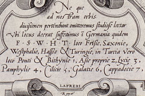
The cartographic image and the text are the same as on Mercator’s map. However, instead of at the bottom between the two hemispheres Mercator had put the text in the South Pole area. The text states the names of the regions in Europe and Asia Minor, which are indicated on the map using letters and numbers due to a lack of space. In the text at the top of the map, Mercator states that he is working on a map of Europe. This map – a large wall map of Europe – was published in 1554. Lafreri copied this text word for word, without mentioning that the map had already been published years before!
Blank spaces on the map
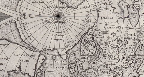
At the time, large areas of the world were still unknown. This is reflected on the map. For example, 'Littora incognita' (unknown coast) is included in two places in America. The area of the North Pole is partially represented as land ('Ulteriora incognita': the rest of the land is unknown, is included near Greenland) and partially as frozen sea ('Mare Glaciale'). In the South Pole, there is a text stating that while there is definitely land here, there is a lack of certainty regarding its correct size and shape. Other areas were only known from travel reports, from Marco Polo, for example. The small island 'Sipango' represents Japan and 'Cathai' represents China.
Author


