A recycled Dutch East India Company chart
The secret of eternal life
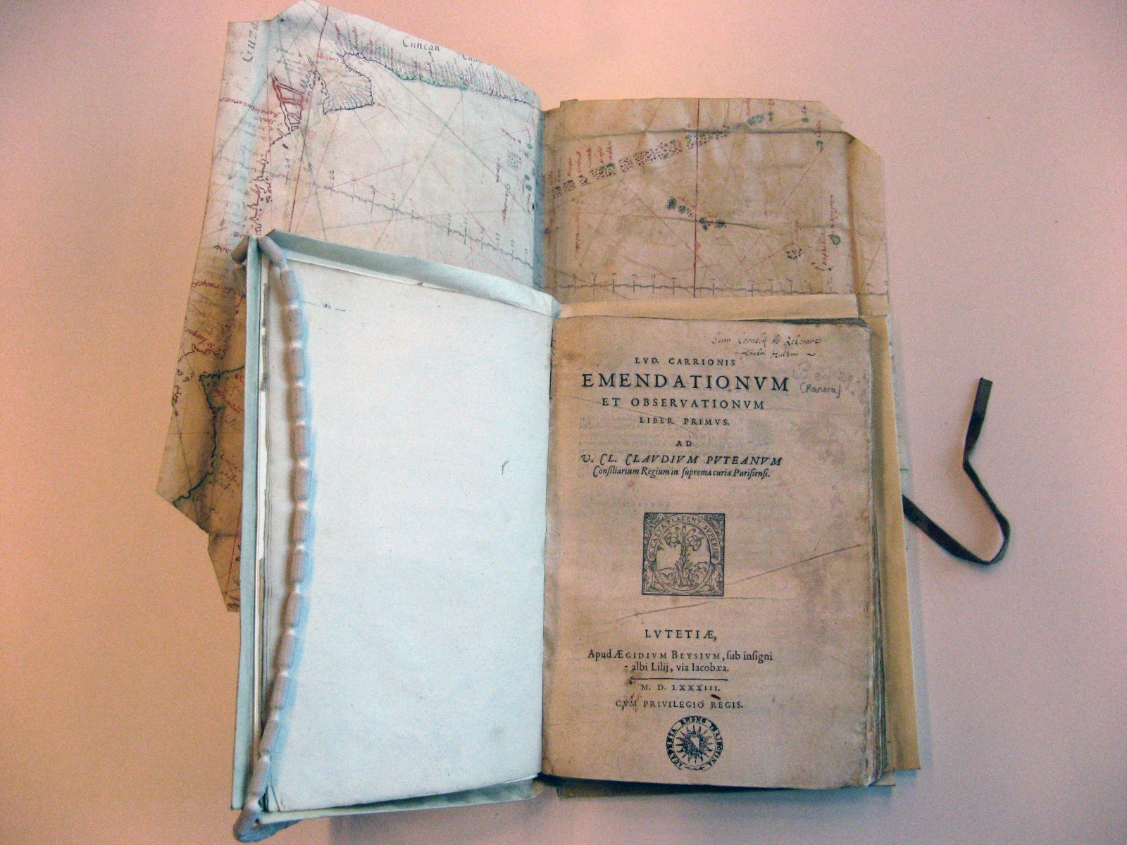
Recycling products that are no longer used is hot nowadays. Yet in the past people also used to recycle things that no longer served their original purpose. For instance take a look at this fragment of a 17th-century manuscript chart of the Dutch East India Company. This fragment on vellum had started a new life as (later) book cover for the work Lud. Carrionis Emendationum et observationum, published by Gilles Beys in Paris in 1583.

Part of an outline map
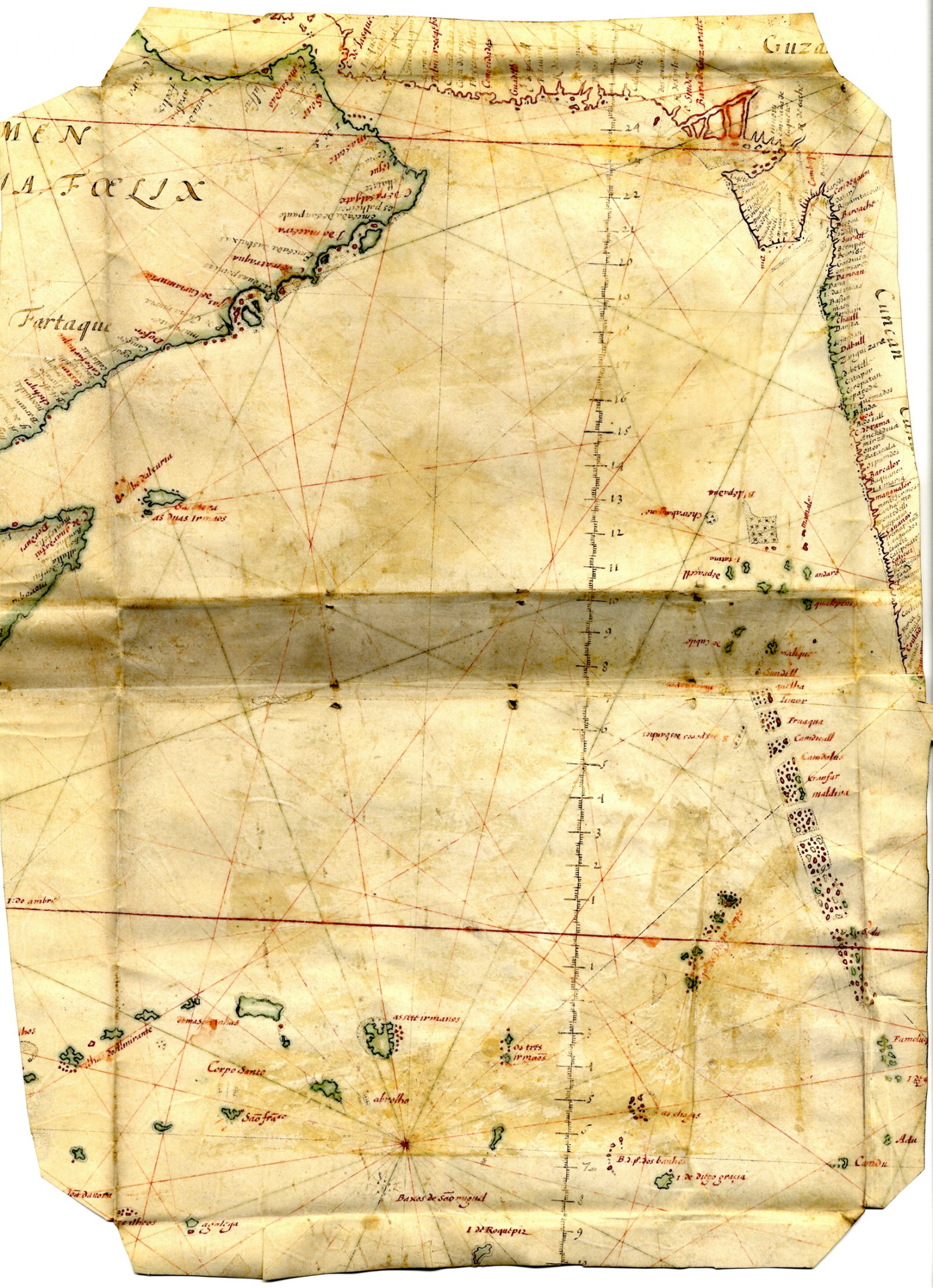
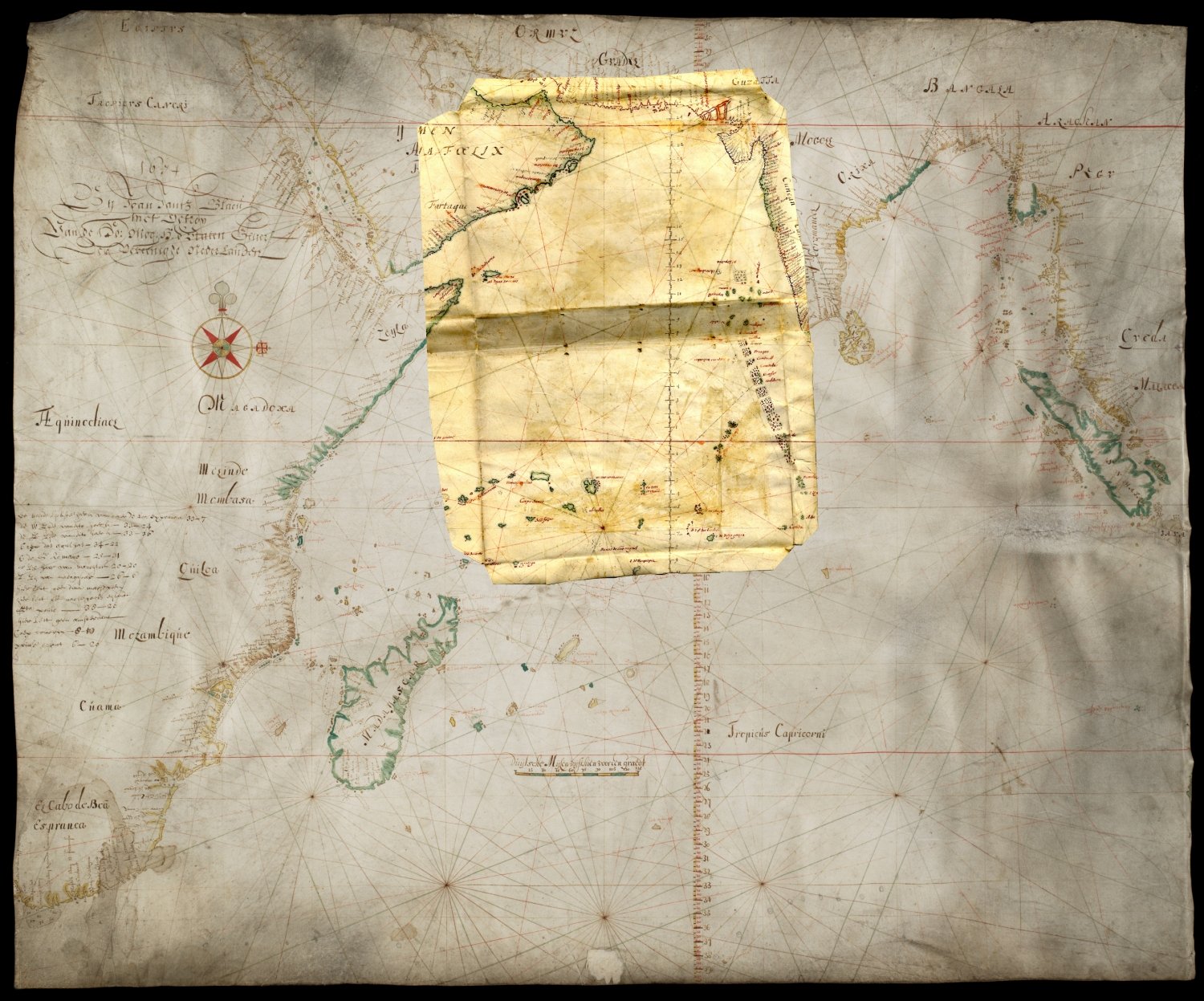
The inside of the old cover, measuring 40 by 30 cm, shows in manuscript parts of the Indian Ocean, the Arabian Peninsula and India. The fragment used to belong to a (probably) 17th century outline map of the Indian Sea or Ocean, an important part of the Dutch East India Company patent area at that time.

Strict organisation
The Dutch East India Company had reliable nautical charts made by cartographic workshops. It was a well organised company with strict rules on equipping ships. Lists were kept of the navigation material that was taken on-board. The master mariner and petty officers had to sign for receipt and they also had to undertake to hand in the material upon safe arrival in Batavia
Tens of thousands of cattle sacrificed
Recent figures show that between 1602 and 1753 – the year that the Dutch East India Company switched exclusively to printed charts – around 70,000 parchment charts made of animal skins had been produced for the company. Of these only a couple of dozen are kept in public Dutch collections and worldwide only a couple of hundred. In the book Sailing for the East, which was published in the series Utrechtse Historisch-Cartografische Studies in 2010, Günter Schilder and Hans Kok offer a richly illustrated overview of this important cultural heritage.

A new life as book cover
As said before some Dutch East India Company charts partly or completely survived the ravages of time by being used as book covers. In this respect the Utrecht fragment is no exception and more examples of such reuse are known. For instance, the administrators of some smaller departments of the Dutch East India Company had their payrolls bound in outdated parchment sea charts. And also the oldest known printed map of the Dutch territory partly ended up as book cover.
True to life?
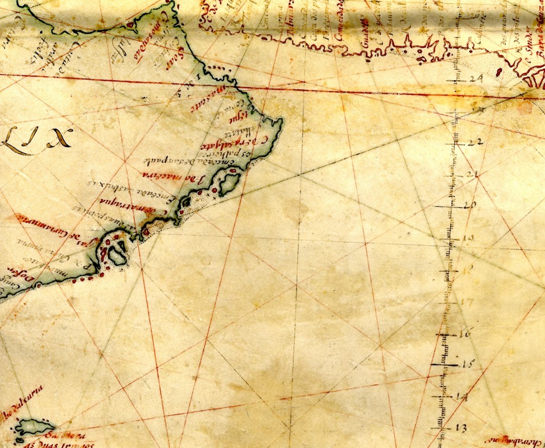
Now when we take a closer look at the fragment some things catch the eye. The Maldives Archipelago, at the bottom right, shows a strict and diagonal pattern. This schematic configuration of the Maldives is typical of the Dutch East India Company charts of this period, but does not reflect the reality in which the Archipelago is almost entirely oriented North-South. The same goes for some islands at the bottom left of the fragment. Possibly these islands were mapped because they were regularly recorded but each time at different positions. The general geographical names on the mainland are written in black ink. The red place names refer to the presence of Dutch East India Company locations.

Compass Lines for navigation
The straight lines on the chart are compass lines helping the master mariner to navigate and plan the sailing route. At the bottom left the fragment shows a point where several compass lines converge. This is the central compass rose, characteristic of sea charts. Around this rose, complete compass charts generally have sixteen secondary compass roses which are all linked by lines. This creates a network of so-called rhumb lines which make a right angle with all meridians and which make it possible to navigate using a fixed compass point.
Plane variety
The collection of maps at the Utrecht University Library currently comprises six valuable Dutch East India Company charts on vellum, all made by Isaak de Graaf who was chief map maker at the Amsterdam chamber between 1705 and 1743. These are maps of the Atlantic Ocean, Sumatra, the Sunda Strait, the Java Sea (two copies) and the northern coast of Java. The library therefore has five of the seven standard charts on vellum which were used on board the East Indies fleet in the first half of the 18th century.
Still missing are the two outline maps of the Indian Sea: one plane chart and one in Mercator projection (in which the degrees stretch towards the poles).However, with this fragment the library owns a small part of such a map on vellum, and the plane variety to boot!

