
'Atlas maior' by Blaeu
The result of a true atlas fight
Ask anyone what comes to mind when thinking of old maps and the odds are that the name of Blaeu is mentioned. The atlases and maps that were printed in the 17th century in the Amsterdam company of the Blaeu family are world famous. It stands to good reason that Blaeu's world atlas Atlas maior with its superior typography is included in the Canon of the Netherlands. Utrecht University Library houses two beautiful editions in the Dutch language of the Atlas maior.

In Blaeu's time Amsterdam developed into the centre of international trade, overseas expansion and wealth. Amsterdam was the place to be for international contacts, money and it was the perfect sales market to start a flourishing publishing firm of maps and atlases. Not only were there enough seamen and merchants around, needing reliable navigation tools, but also many well-to-do citizens were curious about the world beyond the horizon. They were prepared to spend loads of money on luxurious atlases and beautiful world globes and celestial globes.
Blaeu's first steps
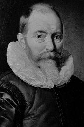
Willem Jansz. Blaeu (circa 1571-1638) responded to this trend with expert knowledge and a good nose for business. After his apprenticeship at the Danish astronomer Tycho Brahe, he established his own print-shop and publishing firm in Amsterdam. From his very first printed maps (dating from 1604) he drew attention by the quality of his innovative maps. Blaeu did not do the measurements himself. He designed his maps based on existing map material, supplemented by the knowledge he took from travel accounts and conversations with seamen. His maps and atlases earned him international fame.
The golden age under Joan Blaeu
After the death of Willem Jansz. Blaeu in 1638 his son Joan (circa 1598-1673) took over the company. He successfully expanded the already flourishing firm. Building on the legacy of his father, Joan attempted a true cosmography, a full description of the heavens, earth and seas as they were known then. This ambition turned out to be too high, but did lead to the publication of the famous Atlas maior. This multi-volume atlas was published from 1662 onwards in several editions and languages and was the climax of the Dutch production of atlases. By its almost 600 maps and some thousands of descriptive pages the nine to twelve-volume atlas offered a view of the world in maps.

Blaeu versus Janssonius
The history of the Atlas maior cannot be told without mentioning the competition between Blaeu's company and its fellow-publisher and neighbour Johannes Janssonius (1588-1664). Both men began an unrivalled atlas race around 1630. It led to a new development in the Amsterdam atlas production. The competition resulted in a large increase in the number of atlas maps. Striking detail is that Willem Jansz. Blaeu entered the atlas market by buying the copperplates of Jodocus Hondius junior, the brother of Henricus Hondius with whom Janssonius closely collaborated at the time.

Up till then Blaeu had only been active in the field of globes and maritime publications. In the course of the 17th century the trade in this kind of publications came to a halt. By using Hondius' copperplates Blaeu could price Janssonius' world atlas out of the market, an atlas that was outdated in his opinion. In 1630 he published the Atlantis appendix sive pars altera with 60 maps, of which 37 were printed with the help of Hondius' copperplates. In their turn Janssonius and Henricus Hondius reacted in 1630 and 1631 by publishing 'new' atlases, containing maps which were copied after the ones by Blaeu.
Increasingly voluminous atlases
An atlas race started which was to last for several decades and resulted in increasingly bulky atlases. For instance Blaeu published a two-volume atlas with a total of 210 maps. Janssonius outdid Blaeu by publishing a three-volume atlas with over 300 maps. And so it went on and on. In 1638 when Willem Jansz. Blaeu died and was succeeded by his son Joan, both publishing houses had set up a new multi-volume atlas: the Atlas novus. After that time they tried to get the better of each other by increasing the number of volumes of this atlas again and again. In their fight they did not hesitate to copy each other's maps. Finally in 1658, both Blaeu and Janssonius had published a six-volume Atlas novus with respectively 400 and 450 maps.

A full description of countries, cities, oceans and heavens
In the long run, the competition between Blaeu and Janssonius led to the publication of an Atlas maior, or 'large atlas'. Janssonius was the first to put such an atlas on the market in German: the ten to eleven-volume Novus Atlas absolutissimus. This large atlas by Janssonius lacked uniformity however, and was mainly composed of existing parts of the Atlas novus. But it was a lot of maps, 500 to 550, and together with the celestial atlas by Cellarius and the eight-volume city books, Janssonius was the only one who realised Mercator's 16th-century concept: a full description of the countries, cities, oceans and heavens.

Blaeu's answer

Of course Joan Blaeu did not sit around doing nothing and he also conceived the plan for a large atlas as part of a cosmography. So in 1662 the Latin edition of Blaeu's Atlas maior was published, in eleven volumes and with 600 maps. In the years to follow French and Dutch editions came onto the market in twelve and nine volumes respectively. A Spanish edition was never finished, and a German edition never saw the light of day. Purely by counting the number of maps in the Atlas maior Blaeu had outdone his competitor Janssonius. And also from a commercial point of view it was a greater success. Partly because of its superior typography Blaeu's Atlas maior soon became a status symbol for wealthy citizens. A non-coloured-in copy cost 350 Dutch guilders, a coloured-in copy cost 450 guilders, making the atlas the most precious book of the 17th century!

Description of the land
As said before Blaeu initially intended to produce a full cosmography with his Atlas maior. The full title is significant in this respect: Grooten atlas, oft wereltbeschryving, in welcke ’t aertryck, de zee en hemel, wordt vertoont en beschreven. ('Large atlas, or description of the world, in which the land, the sea and heavens are shown and described'). Several nine to twelve-volume editions 'only' contain the description of the land. The planned volumes with the seas and heavens never rolled off the presses.
Design of the atlas
In relation to the earlier Latin and French editions, the Dutch edition of the Atlas maior differs, particularly in the order of the maps. The Grooten atlas is not divided into continents, such as the Arctic, Europe, Africa, Asia and America, and 'books', that is the countries and larger regions. This was because Blaeu had a large supply of print sheets which were left over from the relatively recent reprint of the Dutch Atlas novus (1658). That is why the order of the maps in the Atlas novus is based on the order of the maps in the Grooten atlas.
Sources of the maps in the atlas
Just as was the case in his earlier cartographic editions, Blaeu did not spend money on the measuring and mappping of areas for his Atlas maior. He compiled his maps based on several sources, including existing (sometimes hundred-year-old) map material by other Dutch and foreign publishers. Because of this and also due to the fierce competition with Janssonius Blaeu did not produce a very balanced atlas. For instance a more than average number of maps was allocated to the British Isles and to inaccessible China. This was simply because Blaeu had relatively many and original sources at his disposal.
A million copperplate prints
It is not surprising that Blaeu was capable of a megaproject such as the Atlas maior. In its time, the company owned the largest print-shop in the world. In the shop at the Amsterdam Bloemgracht, that had been in operation since 1737,stood nine printing presses and six plate printers. In a second print-shop at the Gravenstraat, opened in 1667, probably most maps were printed. With the help of these modern and well-equipped print-shops Blaeu was able to realise his enormous atlas project: from the Dutch edition with almost 4,000 pages of text and maps to the French edition with over 5,300 pages!
Although the exact number of copies of the Atlas maior is unknown, it has been calculated, based on the number of surviving library copies that there must have been between 200 and 600 copies, depending on the edition. From these numbers follows a staggering total of almost a million copperplate prints and over 5 million pages of text!

Downfall of Dutch cartography
Hardly a century after Ortelius’ Theatrum orbis terrarum, the very first world atlas with a little over fifty maps, the concept of the atlas seemed to be working so well that a giant atlas with 600 maps could be profitable. However, the Atlas maior was also a turning point, after that time the Netherlands did no longer play a role in commercial cartography. Janssonius died in 1664 and in 1672 a great fire burnt down one of Blaeu's print-shops. In this fire also a part of the copperplates was lost. Soon after Joan Blaeu died, in 1673. The almost 2,000 copperplates owned by Janssonius and Blaeu found their way to other publishers.
The world close at hand

The Atlas maior illustrated how knowledge of the world had increased because of voyages of discovery and trade contacts. At the same time the atlas was a popular status symbol and could be bound in expensive leather. The maps, often published before or taken over from other publishers, were beautifully executed. Blaeu had brought the world within reach with his Atlas maior, and had done so in the most beautiful way.
Subsidy
Digitising these atlases has been made possible thanks to a generous subsidy from the K.F.Hein Fund.

Auteur
