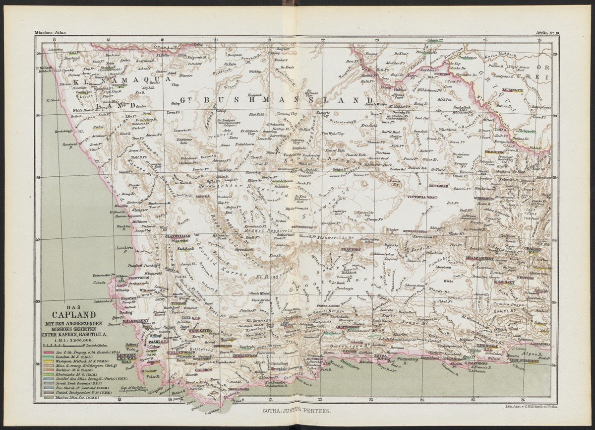
'Das Capland [...]'. In: 'Allgemeiner Missions-Atlas', 1867
This map shows the South African Cape, the western part of what is now South Africa. During this period the Cape Colony was under British rule, and many Dutch Boers had moved north in the Great Trek. Their republics are just outside the confines of this map. In 1867, the year this atlas was published, diamonds were discovered at Kimberley, with tremendous economic potential.
Missions from many British, French, Dutch and German organizations are marked by colors. Notable are the activities of the Rheinische Mission in the north-western area on the border of what is now Namibia, which would become German South-West Africa in 1884.
The map was published in the General Missionary Atlas by Reinhold Grundemann (1836-1924), which appeared between 1867 and 1871 in four volumes (20 maps of Africa, 29 maps of Asia, 12 maps of Polynesia and 11 maps of America). In the preface Grundemann wrote:
‘No matter how many mission reports one reads on such missions, the impressions they give do not linger in our memory, because we have not, as it were, made a pattern through our knowledge of the different locations they deal with, where we can absorb and collect the impressions’.
His atlas, he says, shows what is possible ‘When geography and mission go hand in hand.’
Grundemann was a prolific theologian who brought about the professionalization of missionary cartography. He produced a number of high-quality missionary atlases, especially in comparison with the earlier, sometimes simple maps. Grundemann had studied theology in Tübingen, Halle, and Berlin, and became a minister in 1861. His interest in missions and cartography led him to undertake missionary and study trips, where he collected material for the General Missionary Atlas, which is divided into four volumes. appeared between 1867 and 1871. A smaller version, the Minor Missionary Atlas to present the evangelical missionary work according to its current state, appeared in 1886, and a revised atlas, the New Missionary Atlas, in 1896. Typical of Grundemann was the more scientific approach and precision of his maps. Where earlier maps, for example, only marked ‘heathen’ territory, Grundemann distinguished eight variants of natural religions in an exceptionally beautiful mission world map.

!['Das Capland [...]'. In: 'Allgemeiner Missions-Atlas', 1867](/sites/default/files/styles/image_1600x300/public/UBBC_DigTentoonstellingen_Missie_TN18%20-%20Kaap_banner1600x300.jpg?itok=GKOwFajS)
