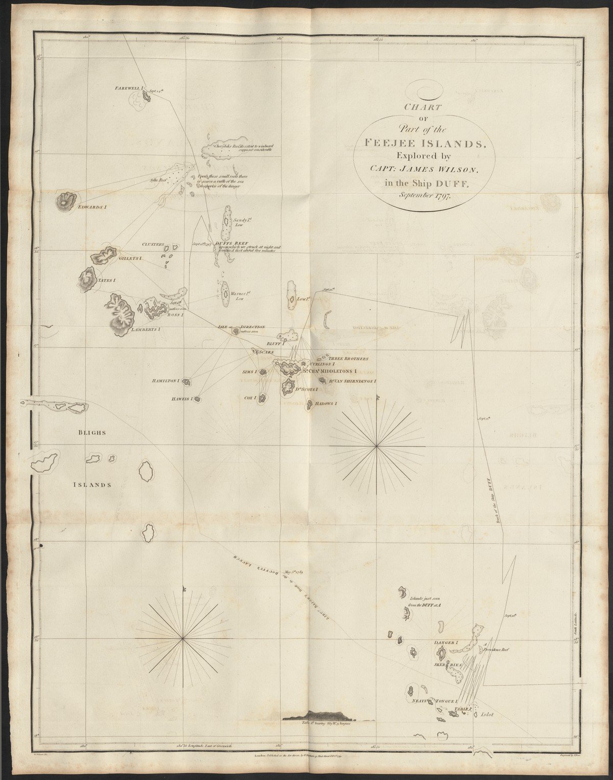
'Chart of part of the Feejee islands [...]', 1799
This map of the Fiji Islands appeared in an account of a voyage of discovery for the benefit of mission to the South Pacific: A missionary voyage to the Southern Pacific Ocean, performed in the years 1796, 1797, 1798, in the ship Duff, commanded by captain James Wilson. It is clear that not all islands had been visited yet. Some islands are only partially drawn and probably only seen from a distance. Occasionally it is indicated: ‘natives seen’. In the appendices of the book more information is given about the residents, their administration, customs and religion.
Fiji was first seen by Europeans in 1643 when a Dutch East India Company ship belonging to Abel Tasman passed by. In 1773, James Cook briefly visited one of the islands, after which contact with the islanders intensified. In 1796, one of the first missionary organizations, the Missionary Society (later London Missionary Society), ordered this trip. The foreword to the report indicates the importance of cartography for the missionary movement: ‘The relation which geographical knowledge bears to missionary exertion is as obvious as it is important’. The trip was well prepared: travel reports were reviewed and interviews with travelers were held. ‘An extensive compilation of this nature was put into the hands of missionaries; and several maps were constructed to illustrate the geographical details.’
The intertwining of mission and imperialism was made explicit: the book was dedicated to King George III: ‘Whatever beneficial consequences may result from the attempt, we shall be happy to ascribe them, under God, to Your Majesty's government as their origin.’ The book contains several maps of island groups in the Pacific.

!['Chart of part of the Feejee islands [...]', 1799](/sites/default/files/styles/image_1600x300/public/UBBC_DigTentoonstellingen_Missie_TN4%20-%20Fiji%20Islands%20I_Banner1600x300.jpg?itok=JKj5EB8V)
