Explanation of the digital exhibition 'Fortress Europe'
2014 - the year of setting up this exhibition - was the 300th anniversary of the ending of the War of the Spanish Succession (1701-1713/14). The Spanish King Charles II had died in 1700 without leaving heirs and after his death mainly European powers battled over the question who had the right to succeed him. The French ‘Sun King’ Louis XIV, with his allies Bavaria and Spain was up against the allied armies of England, the Dutch Republic, the German emperor, Prussia and the Austrian Habsburg family. A bloody war was the result, in which all kinds of European cities lay under siege or witnessed fierce battles. After more than ten years of heavy fights resulting in tens of thousands of casualties the Peace of Utrecht and the Peace of Rastatt made an end to the war.
Printed news maps and fortification plans
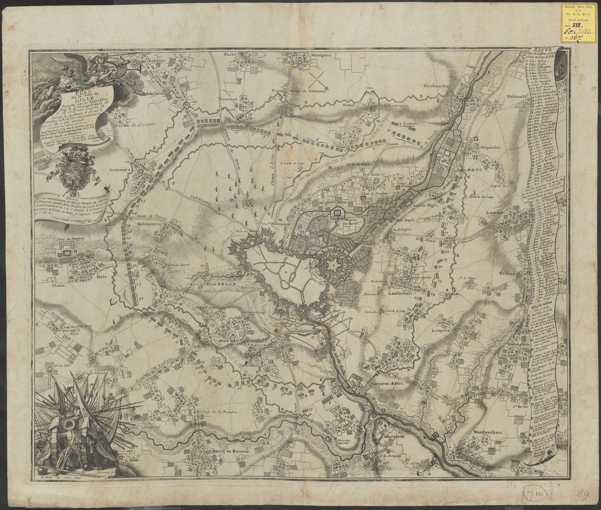
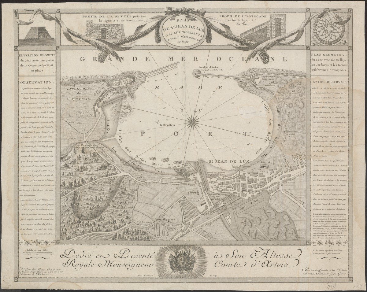
During the War of the Spanish Succession the general public liked to be informed of the war acts taking place all over Europe. Booksellers met this demand by printing and publishing pamphlets and leaflets. These short texts gave an overview of the actual situation. Also the newspapers reported about the war, but they were mainly distributed locally or regionally. The publishers reached a larger audience by publishing siege maps or news maps: printed maps with clear images of the siege or battle, with or without explanatory notes. Furthermore, printed fortification plans showed the strength of the fortified European cities.
Manuscript maps by engineers
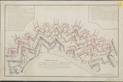
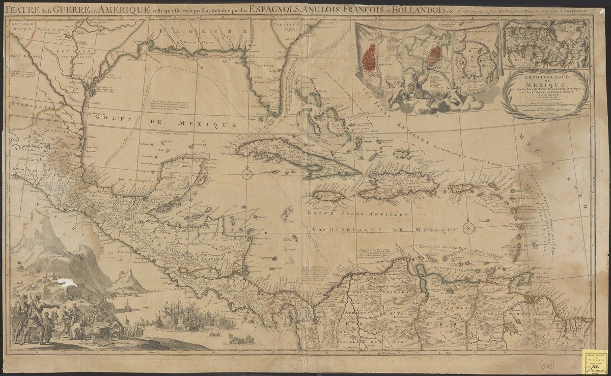
Besides the siege maps and fortification plans another kind of map became a success during the War of the Spanish Succession: maps by engineers. These were mainly fortification maps which were drawn by hand by military engineers. These maps were intended to improve the local fortifications. The work done by the military engineers was very important in the warfare of those days. Famous fortification architects such as Menno van Coehoorn (1641-1704) and Sébastien Le Prestre de Vauban (1633-1707) even owed their reputations to their designs of fortifications considered to be unconquerable.
Maps in Utrecht
Utrecht University Library houses a large collection of these kinds of siege maps, fortification plans and engineers’ maps. They offer a splendid visual image of the events during the War of the Spanish Succession. Also of many other succession wars in the turbulent 18th century the library has often unique cartographic material in its vaults. For instance of the Northern War (1700-1721), the Turkish War (1715-1718), the Polish Succession War (1733-1738), the Austrian Succession War (1740-1748) and the Bavarian Succession War (1778-1779). In addition, there are smaller numbers of maps bearing witness to military operations and situations from the 17th and 19th century.
Moll collection
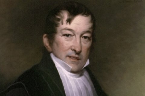
The siege maps, fortification plans, and engineers' maps are mainly part of the collection of the Utrecht professor, Gerrit Moll (1785-1838). In 1812 Moll had started as professor in Mathematics and Physics. For his teaching and research activities he compiled a large collection of documents which were donated to the library after his death. To this collection 1,500 maps and a dozen atlases belong. It is a very versatile collection with, as said before, much room for large-scale maps of mainly European fortifications and battles. It concerns over 100 documents which Moll probably collected out of personal interest.
Digitisation
In 2014 Utrecht University Library digitised the siege maps, fortification plans, and engineers' maps from the Moll collection and published them on the internet. In this way Utrecht University Library made access possible to an important source for teaching and research in the fields of historical landscapes, architecture and the history of cities. The maps are in general detailed and accurate and sometimes richly illuminated. This means that they are not only important sources for teaching and research, but also a treat for the eye of the general public.
Georeferencing
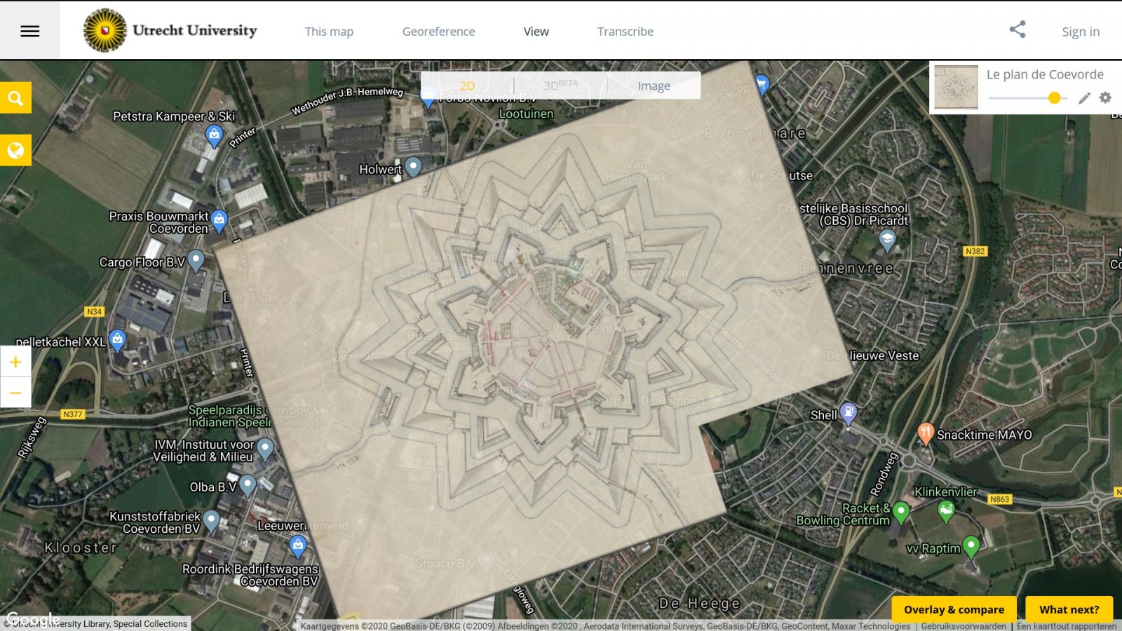
Digitising siege maps, fortification plans, and engineers' maps and publishing them on the internet is of course a good cause in itself. However, the documents get an extra dimension by adding them as a layer to a geographical medium. This so-called georeferencing has also been performed in the project Fort Europa. To georeference the siege maps and fortification maps use is made of Georeferencer. With the help of this application, coordinates and reference points can be fairly easily added to scanned maps. Next the georeferenced maps can be consulted via link to Georeferencer’s own viewer. It is also possible to assess the accuracy of the georeferenced map in Georeferencer.
Old maps, new technology
For each map the university library gives access to the scan in Georeferencer. By clicking on a map in the digital exhibition it is shown in the library’s viewer. In the left menu you will find the link to the scan in Georeferencer (‘Georeferences’). In this applications it is possible to zoom in on the map. The map can also be made transparent (small slide top right). Now comparisons with the current situation are possible. By the new techniques the old maps can be analysed as never before.
Advantages of georeferencing
Except that georeferenced maps are represented in modern and advanced interfaces, there are other advantages as well. It is possible to – by opening various map layers – to put old maps on top of each other and compare them with each other. Next new ways are found to analyse old maps or to link them to other spatial information. Last but not least georeferenced maps offer excellent possibilities to improve their accessibility.
Improved availability via OldMapsOnline
The website of OldMapsOnline (http://www.oldmapsonline.org) is an internet portal that gives access via a geographical interface to thousands of scans of cartographical documents housed in several libraries and institutions. Also Utrecht University Library has included references to its georeferenced maps in this portal. By zooming in on the map of the world, the underlying scanned maps of the selected and framed areas are shown. By clicking on a map, one is led to the website of the institution which houses the map in question. The interactive map below (full screen for a better performance) also offers the possibility for specifically browsing the georeferenced maps of Utrecht University Library.
Design
In the digital exhibition the collection of siege maps and fortification maps is arranged in chronological order. By clicking on it, each map can be viewed in the viewer of the library in which also references can be found to, for instance, document data (title, author, scale, publisher, technique, measurements, bibliographical data etc.), the PDF of the document, the library catalogue, and the georeferences. In addition each map is accompanied by an scientific explanation in which the context of the map is outlined. The scientific explanations are written by dr. M. van Egmond, curator of Utrecht University Library. The maps have been scanned in the library.
Realisation and funding
Georeferencing the collection of siege maps, fortification plans, and engineers' maps in Georeferencer has been done by first-year students Geo-Information of the Hogeschool Utrecht, under the supervision of dr. E. Heere. In this way the students learned how to handle old maps and how to interpret them. Besides a clear educational perspective, cooperation with the Hogeschool Utrecht is very important to Utrecht University Library. The project could be realized thanks to a large subsidy from the K.F. Hein Fonds and the Fentener van Vlissingen Fonds SHV.


