'Liber chronicarum' by Schedel
On the threshold of a new world
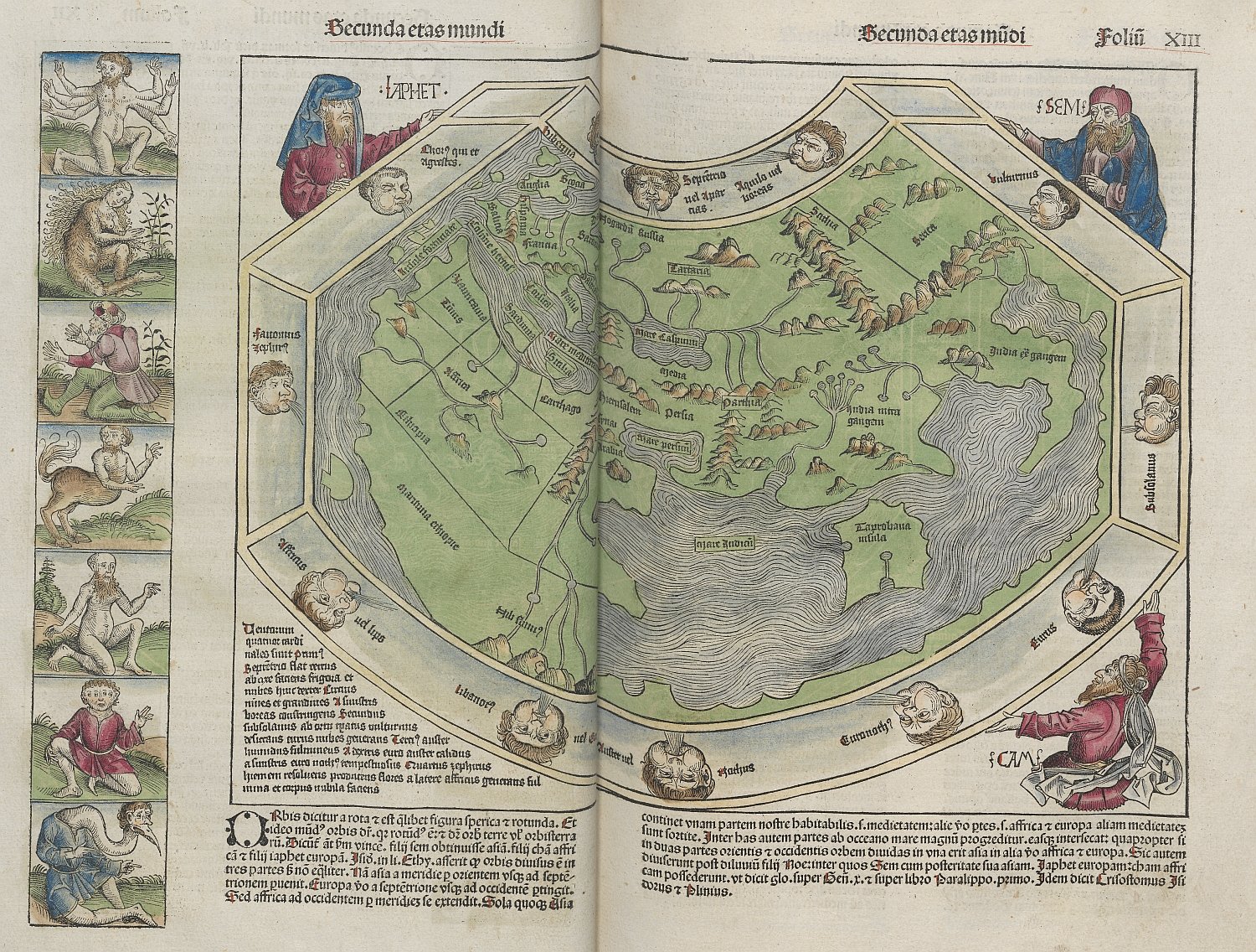
A six-armed man, a centaur, a person with elephant ears; rather peculiar characters that frame the map of the world in the Liber Chronicarum, a chronicle from 1493. Did Europeans from that time really believe that people from Africa, Asia and the undiscovered parts of the earth looked like this? What we do know is that the work of the Nuremberg physician and humanist Hartmann Schedel (1440-1514) is a strange mixture of legends, fiction, non-fiction, tradition and religion. In this most richly illustrated incunable ever published, you will also find townscapes and maps.
As a product of humanism, the Liber chronicarum is a synthesis of religion, empiricism and classical antiquity. It is no wonder that of all people Schedel published the famous chronicle of world history. After all, he lived right in the centre of humanism: Nuremburg. Schedel grew up in the transitional period from the handwritten to the printed book and became an ardent book collector. In Nuremberg he found himself in the the excellent company of "arch-humanist" Conrad Celtis (1459-1476), but he also came into contact with the cosmographer Martin Behaim (1459-1507) and the astronomers Johannes Müller (Regiomontanus, 1436-1476) and Johannes Werner (1468-1522). The Nuremburg humanism was characterised by research into scientific, astronomical and astrological issues.
In combination with Schedel's personal interests in the field of medicine, philosophy, history and geography the ideal breeding ground was created for the Liber chronicarum. To really understand the topographical value of this world chronicle, it is important to have some knowledge of the characteristics, contents and sources of the book.
The 'Liber chronicarum' in figures
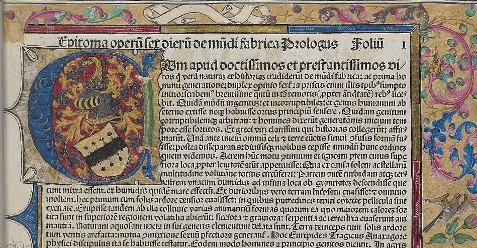
The 'statistics' of the Liber chronicarum, which was financed by Sebald Schreyer (1446-1520) and Sebastian Kammermeister (1446-1503) are impressive. The work has over 600 pages and both in the Latin and German edition there are more than 1,800 illustrations. The printer, Anton Koberger (circa 1440-1513), used nineteen already existing woodcuts from the Postillae (1481), while the other 633 woodcuts came from the workshop of artists Michael Wohlgemut and Wilhelm Pleydenwurff. A total of 652 woodblocks were available, of which 641 to 643 were used for the Latin edition and 639 for the German edition. To reach the total number of 1,800 illustrations, some woodcuts were reused. For instance, one and the same portrait of the pope occurs seventeen times in several places in the book!
Within three decades, the Liber chronicarum saw three reprints, in spite of the considerable price of three to eight guilders, depending on the binding and colouring. Of the Latin edition about 1,400 copies were sold, of the German edition about 700 copies. Because of a reduced and cheaper reprinting by the Augsburg printer Johann Schönsprenger (circa 1455-before 1512) copies were no longer bought by the late medieval consumer from 1496 onwards.
Creation of the world in eight days
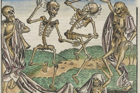
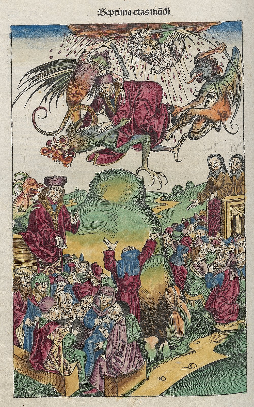
The historiographic genre of the world chronicle was first developed in the Roman Empire and told, in chronological order, a universal history of the world, from the Creation to the Apocalypse. Schedel's world chronicle belonged to the type 'imago mundi' in which, apart from history and geography, also other fields of knowledge play a major part in the description of a worldview. Most world chronicles of this type follow a fixed pattern, with a division into so-called eras in world history. By analogy of the six-day creation of the world, the main model, as included in Isidorus of Sevilla’s Etymologiae, departs from six eras: Adam – Noah – Abraham – David – Babylonian Captivity – Birth of Christ – Apocalypse. Schedel follows this model to a large extent, but adds descriptions of two more eras: according to him the sixth and most recent era runs from the birth of Christ to his own time, the seventh from his own time to the coming of the Antichrist and the eighth and last runs from the Antichrist to the last Judgement. For each era, Schedel gives the length in years, according to the Hebrew and Septuagint calculations.
Copy – paste by other authors
As to the text in the Liber chronicarum Schedel did not come up with an innovative prototype. On the contrary, he diligently collected and compiled texts from earlier authors, not too critical in the analysis of his sources. Schedel's major source was the Supplementum chronicarum by Jacobus Philippus Foresta da Bergamo (1434-1530). This work he supplemented with other texts such as the Speculum historiale by Vincent van Beauvais, the Vitae pontificum by Bartolomeo Platina, the Summa historialis by Antoninus of Florence and several works by Flavio Biondo. Furthermore, Schedel made grateful use of the classical geographical and cosmographic treatises by Ptolemaeus, Strabo and Pomponius Mela.
No Dutch city in the Liber chronicarum
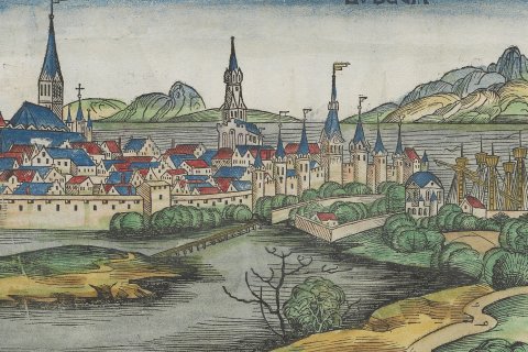
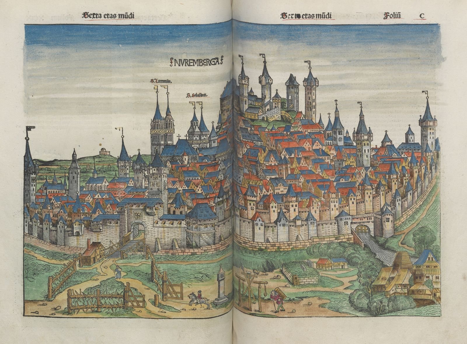
In the Liber chronicarum Schedel attempts to join together the Biblical and profane history, with lots of emphasis on the descriptions of cities and countries. For instance, in the various eras in world history he has the founding of cities run parallel with Biblical history; that is why the descriptions and pictures of cities are spread throughout the entire book. They are mainly European cities, with an overrepresentation of German places. In the Liber chronicarum we mostly find the oldest known topographical picture of a particular city, but they are often far from being a reliable representation of reality. Also here we see that some woodblocks are used several times. The townscape of Mainz, for instance, occurs in six different places in the book. This means that five other cities are depicted as Mainz!
There are about 120 pictures of cities and countries and only 32 of them are depicted true to reality. A part of these townscapes is based on personal observations by Wohlgemut and his colleagues. In addition, authentic contemporary examples were used, such as in Bernhard von Breydenbach's Peregrinatio in terram sanctam (1486) and Werner Rolevinck's Fasciculus temporum (1474). The authentic townscapes are mainly German cities, but also the cities of Jerusalem, Rome, Florence and Genoa are based on a reliable contemporary source. It is remarkable that in the Liber chronicarum there is not a single town from England, Spain, the Netherlands or Flanders.
Recording strange creatures
With the exception of some maps of special buildings, Schedel's world chronicle only includes two country maps: the world map mentioned earlier, and a map of Central and Northern Europe.
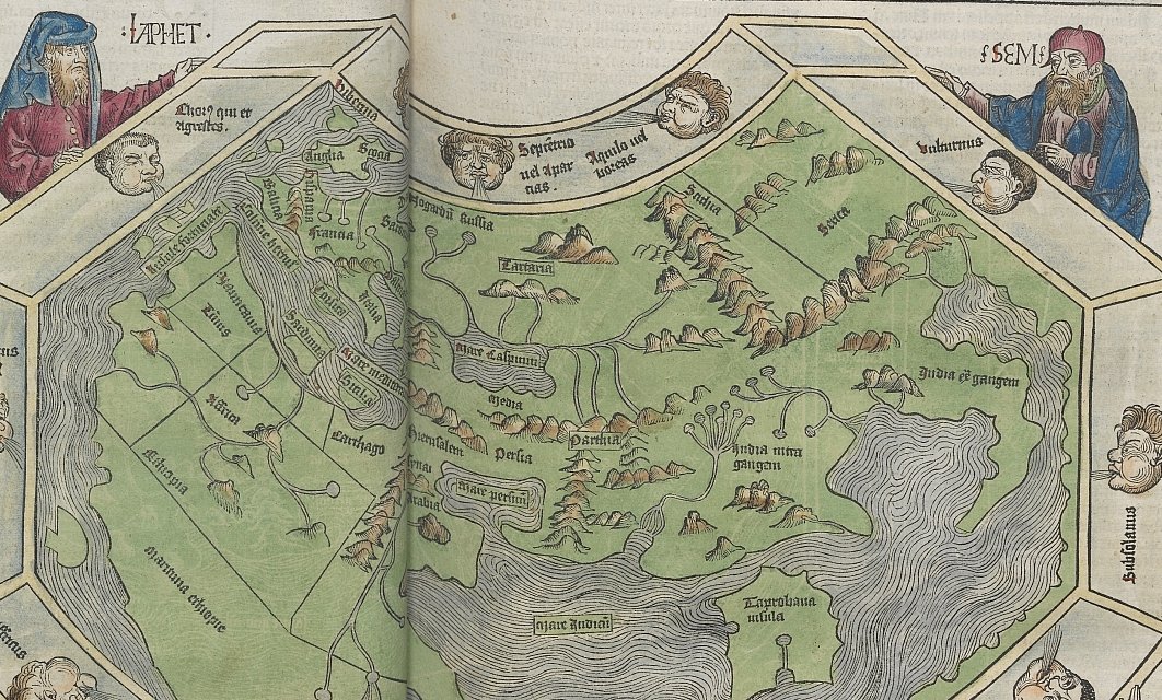
The map of the world is not only interesting because of the 'side panels' to the front and back, containing strange and mythological figures and creatures, but also because of the theologian-empirical mixture. In this way the map is a perfect reflection of the content of the Liber chronicarum. The Ptolemaeus map from an edition of Pomponius Mela’s Chorographia (1482, Venice) served as an example. The characteristic feature is the Indian Ocean, which is closed in on all sides. Based on the information known in that period, the outlines of the three continents are represented fairly accurately. The course of the Nile from south to north is correct, as well as the indentation of the Gulf of Guinea. The results of the most recent voyages of discovery, such as made by Bartolomeu Diaz (Cape of Good Hope, 1488) and Christoffel Columbus (America, 1492) are lacking.
In the corners of the map of the world we see Noah's sons Shem, Ham and Japheth. This is a depiction of the second era in world history, in which the whole human race descends from the sons of Noah (Genesis 9:18-19). They were responsible for the scattering of mankind over the entire world and became the the forefathers of the three well-known continents: Shem for Asia, Japheth for Europe and Cham for Africa. The variety of the peoples is shown in the 21 illustrations of monstrous figures which are a mixture of Arab and Greek myths and the fables of the Occident.
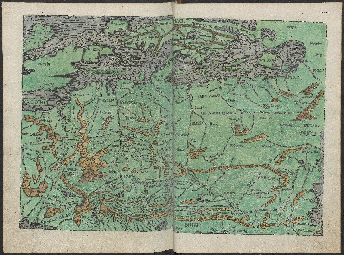
The map of Central and Northern Europe is made by Hieronymus Münzer (1437-1508) and belongs to a description of Germany in a chapter on Europe. This map can be found at the back of the Liber chronicarum as part of the seventh era in world history. It concerns the earliest map of the German territory which was included in a printed book. The map image goes back to the Cusanus map from 1439. Multiple manuscript copies of this map were in circulation. Also in Eichstätt in 1491 a copperplate engraving of the map was made: Münzer used this printed version as example.
Embodiment of the prevailing spirit of the times
It should be clear: from an academic point of view, the townscapes and maps in the Liber chronicarum are sometimes naive and not always very edifying. Although some cities owe their earliest depiction to the book, many townscapes are incorrect, due to the reuse of woodcuts or just fantasies. The map of the world and the map of Central and Northern Europe are based on older, classical examples and not very up-to-date. However, it was never Schedel's intention to outline an accurately geographical image of the world. By the Liber chronicarum he wanted to create a product of humanistic self-awareness. In this way he embodied the prevailing spirit of the times by a combination of theologian traditions and empirical knowledge in a innovative integration and unity of text and image. The Liber chronicarum found itself on the threshold of a new world and would become a link between the old, mostly religious worldview of the Middle Ages and the new, more scholarly view of the Renaissance.
Author
