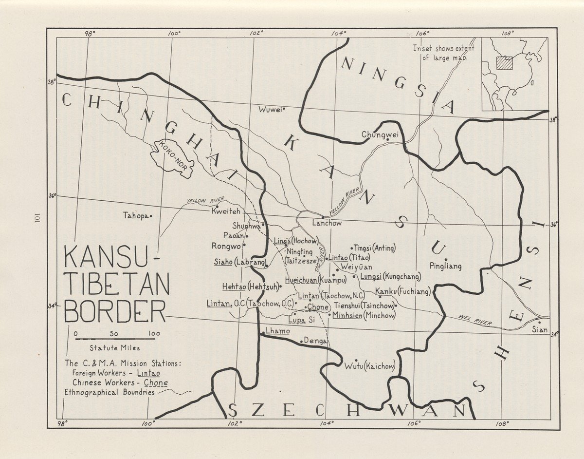
‘Kansu-Tibetan border’. In: 'Missionary Atlas', 1950
The layout is almost identical to that of 1936, but a small inset map here helps the reader locate the Gansu region in China. Remarkably, the only mission in Tibet, Xunhua (Shunhwa: where the Yellow River flows out of Tibet) seems to have disappeared. The number of missions has shrunk slightly compared to the 1936 map. CAMA missions are underlined. Dotted underlined mission posts indicate that the posts are staffed only by Chinese. Where in the 1936 map a distinction is made between ‘mission stations’ and ‘mission stations staffed by Chinese,’ this updated map refers to ‘Chinese’ and ‘foreign’ missionaries. The solid line indicates the border between China and Tibet and the dotted line the ethnographic border.
This atlas was made to visualize the work of CAMA. CAMA was founded in the United States in 1887 and was associated with the Pentecostal movement. The affiliated churches are now evangelical and strongly missionary. CAMA has more than six million members in 22,000 churches and operates in 88 countries. Its headquarters are in São Paulo.
This atlas was published in 1950 by Alfred Cookman Snead (1884-1961), a CAMA missionary to India in the first decade of the twentieth century. From 1921 to 1956 he was responsible for CAMA's foreign strategy. This atlas is arranged by country and provides information about, for example, population, climate, governance and history. This is followed by extensive information, accompanied by black-and-white photographs, about the geographical distribution and the activities of missionaries. The maps are simple and printed in black-and-white and show the missions of CAMA. This atlas was published in 1950, but earlier editions appeared in 1924 and 1936. Here too, a reference is made to the ‘rapid changes in the world’, especially in the Near East. Noteworthy is the folded world map in which time zones are indicated, perhaps characteristic of a period in which civil aviation made faster travel possible. In the front of the atlas is a handwritten dedication from Snead: ‘To my esteemed friend Dr. J.V. De Bruyn’, an administrator in the Dutch East Indies and ethnologist about whom a novel was later written by Anthony van Kampen, Jungle Pimpernel.


