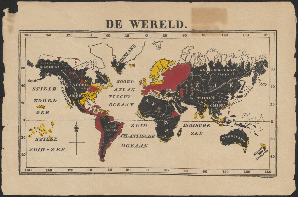
'De wereld', by T.M. Looman, 1850
This map from 1850 shows a bird's eye view of the spread of Protestantism and not so much missionary activities as such. It is a simple map for children and shows the distribution of religions around the world in three colors. Protestant areas are highlighted in yellow, Catholic and Orthodox areas are summarized in red. The rest of the world is black, including the Muslim world. The map does not have a legend.

In The Netherlands, the combination of Reveil and the emergence of Sunday schools played an important role in the emergence of missionary literature for children. This movement emerged in the 1840s, a key decade for missionary youth literature. The first magazines for children appeared in England, such as the Baptist Childrens Magazine (1827-) and the Juvenile Missionary Magazine (1844-). The magazines informed readers and also raised money for the missionary movement. They also likely exerted a profound influence on youthful readers. We know this, for example, from Charlotte Brontë's famous novel Jane Eyre (1847), interspersed with references to overseas missions. In the Netherlands, the Youth Mission Journal ran from 1850 to 1868. The magazine was founded by Theodorus Matthijs Looman, founder of De Gids der Jeugd and one of the first authors of Christian children's stories.
This map appeared at the very front of the very first issue of The Youth Mission Journal in 1850, showing the importance of cartography to the missionary movement in general and to children in particular. It was also around this time that the very beautiful Missionary Map for Children was published in London in 1843 by James Nisbet.

