!['Chart of part of the Feejee islands [...]', 1799](/sites/default/files/styles/image_1600x300/public/UBBC_DigTentoonstellingen_Missie_TN4%20-%20Fiji%20Islands%20I_Banner1600x300.jpg?mt=1606402909&itok=JKj5EB8V)
Exploration maps
within the digital exhibition 'Maps with a message: missionary cartography ca. 1850-1950'
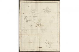 'Chart of part of the Feejee islands [...]', 1799 Commissioned by one of the first missionary organizations
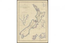 'Chart of New Zealand from original surveys', 1851 Partly based on geographical information from the Church Missionary Society

