
Computational geography and earth observation
Earth observation from satellites and other platforms (aircrafts, drones) is crucial for our understanding of System Earth and to monitor processes at the Earth surface. Accurate information on deforestation in the Amazon and the Congo basins, melting of the ice sheets, occurring droughts as in the summer of 2018 in western Europe comes from remote sensing sensors. The first Earth Observation images were launched in the seventies so we have fascinating timeseries of almost 50 years available to study the dynamics of the Earth. We use images at continental, regional and local level.

We combine data from earth observation with computer simulation. Computer models are essential for understanding and predicting earth surface processes and to evaluate scenarios of climate change or environmental management. The computational geography group develops methods and software tools for spatio-temporal modelling, including large simulations on computer clusters. These tools are used to construct models in multiple domains, for instance hydrology, land degradation, environmental epidemiology. An important component of our research is the integration of observational data and models. Data from earth observation, field studies, or laboratory experiments is combined with simulation models by data-assimilation techniques or used as input to machine learning based modelling.
Computer models give a simplified representation of earth surface processes in space and time and will thus never perfectly mimic real-world processes. Models are however essential tools to assess the effect of human-decision making and to understand the complex behaviour and feedbacks of systems, in particular when combined with large data sets from earth observation.
See also computationalgeography.org
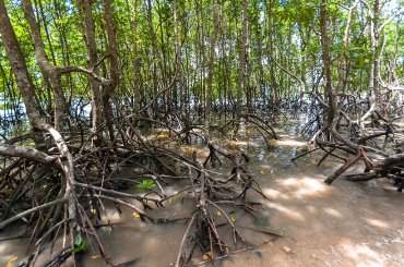
MangroMud: Mangroves for coastal protection in Suriname
Physical geographers are studying the long term development of the Surinamese coast using satellite images, aerial photographs and models.
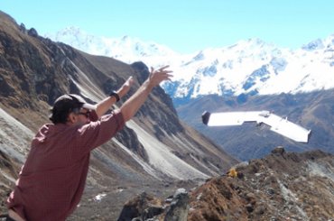
Drones in the Himalayas
Using models, field observations and remote sensing from satellites and from drones to study the hydrology of mountain regions.
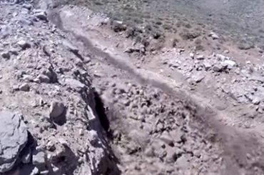
Debris flow on the Aconcagua in Argentina
Mass movements are hazardous events that may cause up to tens of thousands of fatalities. The video shows a debris flow in on the Aconcagua in Argentina.