Maps with a message: digital exhibition about missionary cartography
More than spreading the gospel
Old missionary maps carry with them the heavy load of the history of mission, the mixed heritage of imperialism, suppression and racism as well as education, development and medical care. Therefore, their historical significance is not limited to the expansion of Christianity, but also connects to the development of global relations and imperialism more general.
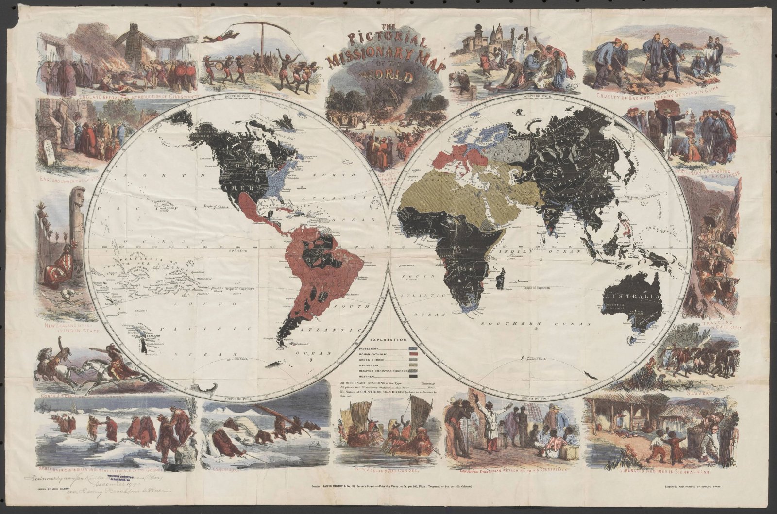
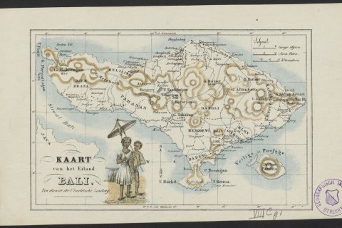
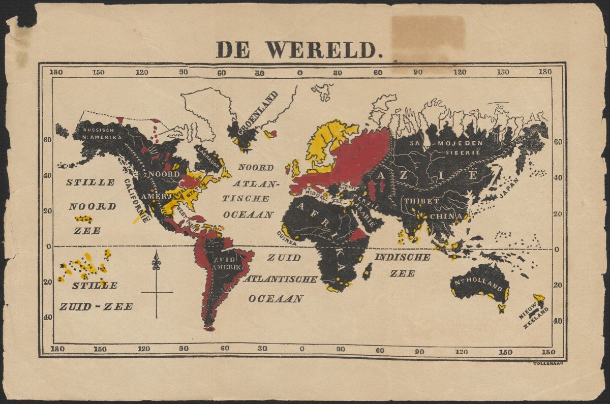
The maps in this exhibition are a lens on Western attitudes with regard to the non-Western world.Maps that show the spread of the gospel can be found in all shapes and sizes. Mere sketches made by the missionaries themselves, wall maps shown during lectures to raise money for the mission, world maps or maps that only highlight a particular area, simple maps for children with only three colours of which black represents pagan territory: you can find them all in the digital exhibition Maps with a message: missionary cartography ca. 1850-1950.
Up till now this so-called missionary cartography has drawn little attention. That is why the Missionary Map Project was launched in 2019 to promote knowledge about this subject. Initiator of this project is dr. David Onnekink, Assistant Professor of the early modern history of international relations at Utrecht University. Together with research assistant Hannah de Korte and Marco van Egmond, curator of maps and atlases at Special Collections, he set up the digital exhibition. How do they look back on this project and what does the future hold in store?
What exactly is the Missionary Map Project?
David: When I became interested in the history of the Protestant mission, I also went to have a look at what kind of material is available. The material also included maps. Next I went on a hunt in all kinds of libraries and archives. Marco, with whom I have collaborated before and who has awakened the love for maps in me, came forward with exceptional copies. I found out that little is known about this subject and that is how the Missionary Map Project was born. Until now we have done two things: set up this exhibition and Hannah and I have written an article about a recent missionary map which is not without its controversies: the 10-40 Windows map
Marco has awakened the love for maps in me
This project should be viewed as a pilot. My next step would be to cooperate with other libraries, not only in the Netherlands but also with libraries abroad. What collections do we have in common and how can we make them available? I would really like to develop this project further, together with Marco of course.
Marco: There is a treasure trove of missionary maps to be discovered. And we as a library love the idea of cataloguing this collection and making it available.
David: So we all went on a search. The explanatory notes added to the maps were written by Hannah and me. Besides, Marco had to teach me how a map is made, things like projection and the material used. Each cartographer makes his own choices in the production process. I don’t have that knowledge, so Hannah and I were corrected when we said things that did not make sense. We worked very well together, each of us bringing their own expertise to the table.

Hannah: I clicked through the other digital exhibitions on the Special Collections website and I thought: it would be useful to add the explanatory notes to the digitized maps so you won’t have to switch all the time between maps and text. This idea has been realized by now.
What is also nice to tell is that Pete Holzmann has contacted me in response to our article. He is the one who made the 10-40 Windows map. He would love to talk with us. It is a good thing that the article and hopefully also the exhibition will open up a dialogue.
On what basis did you select the maps?
David: Hannah and I had long discussions about the selection criteria and in all honesty I must say that the choice was partly arbitrary. What we particularly wanted to do was show the broad range of missionary maps, and we added certain categories along the way.
The fact that we only show the Protestant mission has a purely pragmatic reason. From my own expertise I know a lot about Protestant history. And besides, much is already known about Catholic cartography.

The exhibition covers the period 1850-1950. In what way did views of missionary work change over that time and do we see these changes reflected in the exhibition?
David: In the course of time you see the maps becoming more subtle. In 1850 you had Christians, Muslims and pagans, and that whole pagan territory is coloured black. The light of the gospel has not yet reached the area, so to speak. In the early 20th century you can see a change. At first, Hindus and Buddhists were just pagans. At the end of the19th century they start to be classified as world religions. In itself, this is no new information, but you see it beautifully reflected on the maps. Another thing you can see is that black turns into white. This colour indicates: this is an area we yet have to visit. An interesting change to think about. In any case the ideas behind the colours on the maps are very intriguing. For instance on Protestant missionary maps the regions where Catholic mission posts are located are indicated in red. I think this means danger, but what I do know is that red is not a positive colour. Whereas the Protestant territories are blue, a colour that has very positive connotations in the west. Think of the blue helmets, the blue flags of the European Union and the United Nations.

In the explanation of the digital exhibition you write that missionary maps have attracted very little attention among scholars. Why should that be the case?
David: I suspect that cartographers are for the most part interested in the beautiful and well-known maps, let’s say the atlases by Blaeu. That is not to say there aren’t any beautiful missionary maps but in general they are everyday objects. Besides, the paper on which the maps were printed was of such very poor quality that they were just as easily thrown away. Nowadays they are collector’s items, worth a lot of money. The missionary organisations were mostly publishing leaflets or small magazines. Or maps were folded in the backs of books.
Marco: So it is difficult to detect this material. It is called hidden cartography. If a map is removed from a book, we often don’t know where it came from and that is why it is important to have scholars finding that out for us.
David: Research into missionary history may seem somewhat boring and old-fashioned. In the old days church historians described the history of their missionary activities. The emphasis was on the benefits of bringing the gospel. Or on the other hand, historians described the history of colonialism and were of the opinion that missionaries were also responsible for the wrongdoings of the colonial governments. But it is not as simple as that. You must know how to describe the complex and often controversial history of the mission in an unbiased way.
Because of secularization one would think that the missionary movement is on its way back. But that is not the case: the movement is growing worldwide. This development tends to be overlooked, while it is worthwhile investigating.
I would very much like to see young researchers or students being stimulated to study these maps, even though you are not particularly interested in the mission. The maps have so much more to tell, for instance how Europeans look at the rest of the world. Or how a missionary society used the maps to convince their followers to donate money. So I hope that researchers will do more with the maps, and look further than their original purpose.
Would you like to know more about what Special Collections can do for your research and teaching? Have a look at our page about Advice and Support.

